3D laser scanning at Vermont Danby marble quarry
For hundreds, if not thousands of years, the surveying and mapping of mines and quarries has always been one of the most challenging of all the industrial applications regardless of the current state-of-the-art survey equipment and technology. An experienced mine (or tunnel) surveyor was always someone that had to use their ingenuity to overcome many obstacles not found when working above ground. In many cases, a lot of the survey documentation was “stored” in the surveyor’s memory (job security), not on paper because until recently, it was very difficult to provide the required 3D technology needed to make its use cost effective and practical for a real time mining operation.
Over the past 15 to 20 years, the surveying and mapping profession has been undergoing a major transformation. From the analogue methods of measuring distances and turning angles — techniques that go back to the Egyptians — to the use of global satellite navigation systems (GNSS) such as the Global Positioning System (GPS) and perhaps more importantly, what is called 3D laser scanning or LiDAR (Light Detection And Ranging).
Today, most people around the world are familiar with the revolution that GPS has brought to society. With a low-cost receiver, it is now possible to know where you are anywhere in the world in real time to within about 10 meters, which is incredible. With additional sophisticated techniques, surveying professionals can increase that accuracy to establish high-precision networks that can monitor even the smallest movements of the earth’s crust.
What does the power of GNSS have to do with underground mining and quarrying operations? Unfortunately, not much since the receivers must have a clear line of sight to the satellites. For open pit mines and other above ground operations, GNSS is the preferred method of establishing survey control, but below ground, the game changing innovation is harder to come by.
The power of 3D
Enter 3D laser scanning where like most traditional survey instruments, the scanner is self-contained, and unlike a camera which requires some type of background light source, a scanner is an active system that sends out a beam of laser light and therefore can work even in total darkness — perfect for underground applications. Basically, a 3D laser scanner allows a surveyor to capture and document the dimensions of a space in 3D by capturing millions of measurements quickly and accurately using any number of platforms, including tripods, vehicles, handhelds, and most recently, on an Unmanned Aerial Vehicle (UAV). The technology is agile, highly practical and cost effective.
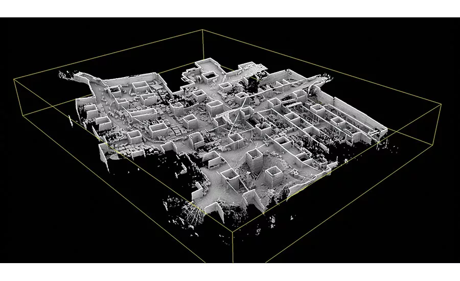
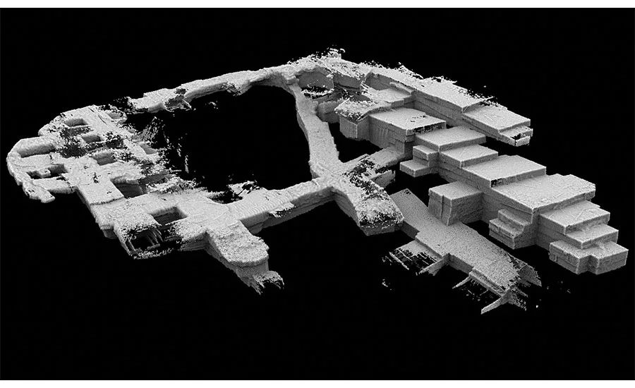
With it now being practical to accurately determine the real world dimensions of an underground mine, a surveyor has the information needed to create a 3D model of an entire operation, including all of the levels, giving a true and complete picture. This is a major transformation from the standard way of managing the mining activities, as the operator can now be supplied with virtually unlimited computer-generated visualizations in both the horizontal and vertical directions, and planes.
The decision to go 3D
It is this capability that led to the relationship between Vermont Quarries Corp. located in Danby, VT, and H2H Associates located about two hours south in Troy, NY. The historic Danby quarry, owned by R.E.D. Graniti and Mazzucchelli Marmi of Carrara, Italy, has a reputation for providing one of the finest marble varieties in North America, and H2H has a proven track record of applying breakthrough technical innovation to mining, quarrying and aggregate operations around the U.S.
When the head geologist at the Danby quarry was searching for a mobile scanning consultant, he came across H2H. Previously, they had been working with another survey firm that was using traditional survey methods to simply determine the volume of marble being removed from the quarry.
After visiting the site and determining the status of the existing mapping, H2H proposed that they establish a new survey control network that would cover the entire site. Once that was completed, they would then use 3D laser scanning to develop a 3D geospatially referenced model of the mine that would have many uses, including tracking inventory volumes, storm water management, structural integrity (pillar alignment) and more.
It did not take long for Vermont Quarries to recognize the potential benefits of using laser scanning to create the 3D model. In addition to those items already mentioned, the data collection is much faster with a laser scanner, more complete, and it is also a much safer method of collecting this valuable data. A multi-year contract was approved to establish the control and then provide quarterly updates documenting the changes that occur as a result of the ongoing mining operation.
The work plan
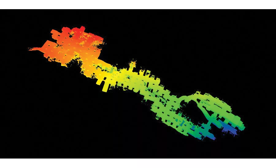
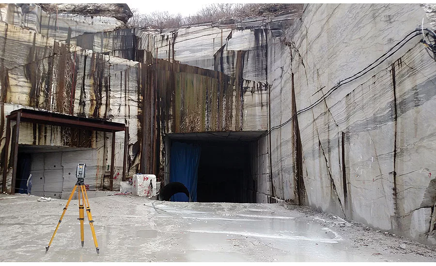
Physically documenting in 3D the largest underground marble quarry in the world presented H2H with a number of challenges, including the overall scale of the operation. Entering through the same opening that has been in use for over 100 years, twisting and turning for 1 ½ miles inside Dorset Mountain to get to where the Danby marble is now being quarried, you get a true sense of the incredible history of the quarry. Using a survey instrument that is a combination of total station and scanner, H2H established a series of highly accurate and permanent survey control points that can be used to locate the 3D scans and tie all of the information together below ground with that to the above grade surfaces.
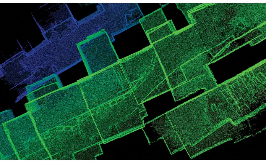
The focus was on the massive stone pillars that are left to support the ceiling of the mine. By accurately locating these with the survey instrument, they could be used to orient and connect the individual scans that were collected for this project using a handheld scanner known as the Zeb1. The technician simply walks around the pillars with the scanner, rocking back and forth in order to collect the required 3D point data. The data is then processed and combined with the survey control data to create the 3D georeferenced model that is accurate to less than 1 foot in the worst case.
The Zeb 1 was selected from a number of 3D data collection and mapping tools that H2H and IMT use to create a complete model of reality in the most efficient manner possible. The Zeb 1 was selected for the following reasons:
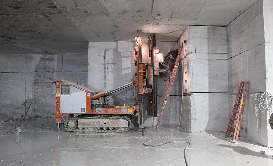
• Safety — close quarters, dim lighting and a bevy of extraction and processing equipment make for a potentially hazardous space for workers. The Zeb1 allows survey technicians to collect data in the most safe, efficient, and complete way possible, while minimizing exposure to the conditions inside the mine.
• Access— limited line of sight between areas that are to be scanned creates a difficult situation for traditional static LiDAR equipment. The mobile nature of the Zeb1 means that a technician can scan all areas that are accessible on foot and in some cases by boat.
• Operations — the process of mobile mapping in the quarry allows the operations to take place without disrupting the daily operations — no shutdown is required.
Deliverables
Using their powerful 3D visualization software, H2H presented the results of their survey to the Danby Quarry management. For the first time, a complete picture and detailed understanding of the quarrying operation was now available. One of the long-time veteran employees, now in his 80s was brought to tears when he saw the 3D images of the quarry where he had worked for a large part of this life.
Since the quarry does not have their own software, the 3D models were used to create 2D survey plans and maps that everyone was familiar with. In addition to the regular volume updates, H2H is working with the management to incorporate exploratory drilling data and a site 3D geologic model into the 3D topographic model to provide even more valuable data. It looks like the Danby quarry will be adding a new 3D chapter to its impressive history.
Looking for a reprint of this article?
From high-res PDFs to custom plaques, order your copy today!


